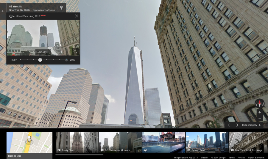
 One Wednesday, April 23, Google announced a new feature for Google Maps. In what is really quite remarkable, Google is allowing users to access old street view images, essentially opening up a time capsule. “Starting today,” the company announced in a blog post, “you can travel to the past to see how a place has changed over the years by exploring Street View imagery in Google Maps for desktop. We’ve gathered historical imagery from past Street View collections dating back to 2007 to create this digital time capsule of the world.”1

This is a really interesting feature. It allows you to take a look back in time – not too, too long though, as the company began taking street photos in 2007. The feature is slowly rolling out, and seems to be mainly focused on major cities and urban areas right now. This will soon change though, according to an ABC News Report:
The visual retrospectives aren’t available throughout Google’s maps, although [Google Product Manager Vinay] Shet says there should be at least one look back in time for just about every neighborhood that can be viewed through the Street View format.2
Further, Google Product Manager Vinay Shet made some forward looking statements about the new feature “As time goes by, many of these images are going to become vintage…We want our maps to be comprehensive as we build a digital mirror of the world.”3
Here is a look at some of the new features in use:
- Vinay Shet, Google Street View Product Manager, Official Google Blog, “Go back in time with Street View,” 23 April 2014 ▲
- Michael Liedtke, ABC News, “Now You Can Travel Through Time on Google Maps,” 23 April 2014 ▲
- Ibid ▲

