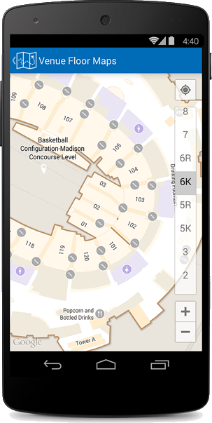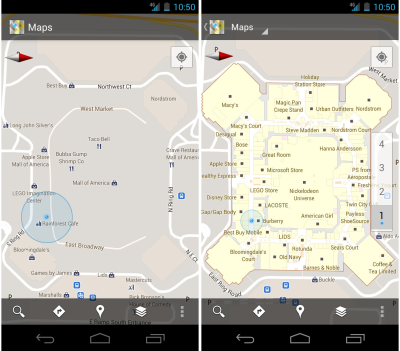
In 2011, Google launched a new Google Maps feature: Indoor Maps.1 This is an awesome feature:
Detailed floor plans automatically appear when you’re viewing the map and zoomed in on a building where indoor map data is available. The familiar “blue dot” icon indicates your location within several meters, and when you move up or down a level in a building with multiple floors, the interface will automatically update to display which floor you’re on. All this is achieved by using an approach similar to that of ‘My Location’ for outdoor spaces, but fine tuned for indoors.2
 Until last week, however, it was unclear how Google managed to create such a feature. Last Thursday, March 27th, Patent Bolt pointed out that Google’s patent application for “for Generating an Indoor Map Model,” had been posted by the U.S. Patent & Trademark office online.3 As the patent application is incredibly technical, here are some of the more non-technical aspects:
A method and system for generating an indoor map model are provided herein. Aspects of this disclosure provide a representation of an indoor map environment whereby navigable areas are represented by a series of convex polygons in adjacency relationships with one another. Image analysis may be performed on a floor plan image to identify navigable areas and to determine the boundaries of the polygons, such as by assigning one or more colors to navigable space and one or more colors to non-navigable space. Route-finding operations may be performed using the adjacency relationships to find a path from a source area to a destination area4
It will be interesting to see if Google ties Project Tango, announced a few moths back, into Indoor Maps in any way. Here is a video showing how you can use Indoor Maps:
- Brian McClendon, Official Google Blog, “A new frontier for Google Maps: mapping the indoors,” November 29, 2011 ▲
- Brian McClendon, Official Google Blog, “A new frontier for Google Maps: mapping the indoors,” November 29, 2011 ▲
- Jack Purcher, Patent Bolt, “Google’s Patent Application for Indoor Mapping Comes to Light,” 27 March 2014 ▲
- Google Patent Application, “Generating an Indoor Map Model,” Filed January 12, 2012 ▲

